Calculating the exact flight distance between two airports involves specialized mathematics, global aviation standards, and real-time navigation systems. Because the Earth is a sphere, plotting a flight path is more complex than simply drawing a straight line on a flat map.
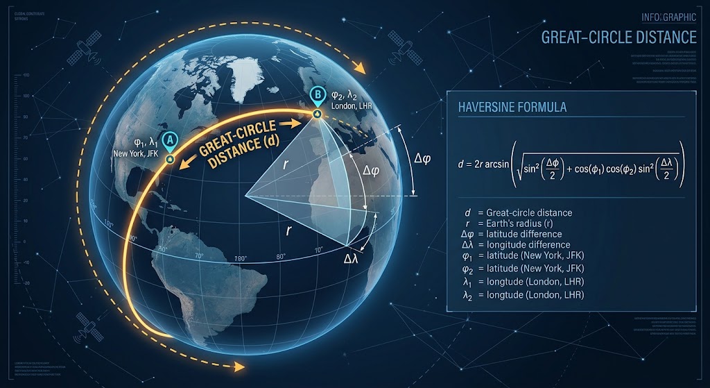
The Foundation: Great-Circle Distance
To determine the shortest distance between any two points on a spherical surface, navigation systems rely on Great-Circle Distance.
A "great circle" is any circle that wraps entirely around the Earth and passes through its center, effectively dividing the planet into two equal halves (the Equator is a prime example). The shortest path along the surface of a sphere between two coordinates always falls along the arc of a great circle.
Flight distance calculations rely on the Haversine formula, a mathematical formula that takes the latitude and longitude of two points and calculates the spherical distance between them:
$$d = 2r \arcsin \left( \sqrt{\sin^2 \left( \frac{\Delta \phi}{2} \right) + \cos(\phi_1) \cos(\phi_2) \sin^2 \left( \frac{\Delta \lambda}{2} \right)} \right)$$
- $\phi_1, \phi_2$: Latitudes of the origin and destination airports
- $\lambda_1, \lambda_2$: Longitudes of the origin and destination airports
- $r$: Average radius of the Earth (~6,371 km or ~3,959 miles)
Key Distinctions in Aviation Calculations
When discussing flight lengths, aviation systems distinguish between pure geographic distance and practical operational distance.
1. Great-Circle Distance (Theoretical Minimum)
- Definition: The direct, "as the crow flies" shortest route over the Earth's curve.
- Usage: Used by flight logging tools, statistical dashboards, and consumer booking tools to establish a baseline mileage between airport coordinates.
2. Actual Route Distance (FPL / Flight Plan)
- Definition: The actual distance a plane flies through real-world airspace corridors.
- Factors: Planes rarely fly strict great-circle paths due to restricted airspace, weather patterns (like avoiding storms), standardized departure and arrival procedures (SID/STAR), and jet streams. Actual route distances are typically 5% to 15% longer than the great-circle distance.
3. Flight Duration (Air Time vs. Block Time)
- Block Time: The total time from the moment the aircraft pushes back from the gate until it parks at the destination gate ("gate-to-gate").
- Air Time: The precise duration the aircraft is airborne, measured from takeoff to touchdown.
- Wind Effects: High-altitude jet streams significantly affect duration without changing distance. Flying eastbound with a tailwind shortens flight duration, while flying westbound into a headwind increases it.
How Interactive Trackers Process Flight Lengths
Platforms like Aviostat take raw airport coordinate data (using official IATA and ICAO airport codes) to calculate precise great-circle baselines. By converting latitude and longitude into radians and running spherical calculations, digital logbooks instantly generate route maps, calculate overall air time totals, and track milestone metrics—like identifying a user's longest or shortest flight—automatically.